GeoContent: GET THE TOP VIEW!
GeoContent is one of the leading providers of aerial photography and precise geospatial information for Germany. Founded in 2001 and with over 30 highly specialised experts in various fields, GeoContent ensures the delivery of up-to-date digital orthophotos, enriched with additional content, and the continual development of new products and techniques.
Under the brand TOPView, GeoContent are able to offer cost-effective and innovative products and services:
TOPView.photo
Serves advertising agencies and media organisations with aerial, oblique and satellite photography of Germany, Europe and the World.
TOPView.map
Produces geospatial information, ready for use in internet and mapping applications.
TOPView.data
Combines all the extensive data and services to build more complex applications for the Geo Information System (GIS).
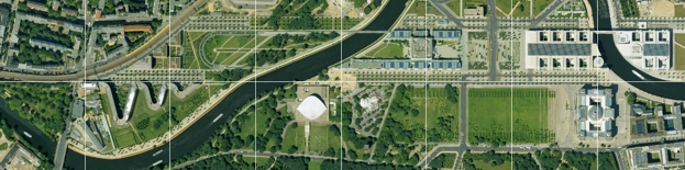
GeoContent is the only provider of an aerial image mosaic of digital orthophotos for Germany, offering consistent, homogenous, seamless and affordable geospatial data with a mapped resolution from 10 to 50 centimeters. All content is continually updated. From 2005 to 2007 alone, we photographed over 180 German towns and cities from the air in high resolution.
In addition to elevation models, we provide house specific roof-top address points, 3D-information and city models as well as a web based Geo Information System. Further features in the program are oblique aerial photos for any object in a designated area from at least four directions.
| AGB | Lizenzen | Impressum | Haftungsausschluss | Sitemap | Datenschutz |